Leader and report: William
Photos: Annette and William
Total distance: 8.8km
Total elevation gain: 445m
Time: approx four hours
This year a bright and cheerful group of 18 walkers arrived at the arranged car park on a warmish but initially overcast day for this year’s walk into Omahu Bush and onto Gibraltar Rock.
From the car park the walk started with a steady climb into Omahu Bush at the Rhodes Track junction with Nelsons Track then dropping down into Anne’s Falls. Again the water flow was not great. Morning tea was on a grassy bank on the track below the falls. We continued on Nelsons Track turning then left onto Kirks Track. At Prendergasts Track junction some of us walked westerly for 150m to a great view of the Canterbury Plains. Prendergasts Track, which is a reasonably steep climb, continues until the saddle just east of Gibraltar Rock. All the tracks are within Omahu Bush which is enclosed by deer fencing and have a QE2 covenant. The undergrowth within the bush varied from near nil to a high number of plants and fern cover. The bush also varied in type from mature black and white Pines and Kanuka. Predator traps are very frequent and vary in type and with the amount of bird song this year it certainly looks like they are doing their job.
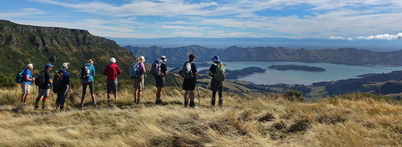
Lunch was held in a clear windless conditions just below Gibraltar Rock, where we all basked in the sun and took in the views around us of Coopers Knob, Mt Herbert, Canterbury Plains, Lake Ellesmere, Main Divide foothills in the haze and Sugarloaf.
Our return walk back to the car park was via Rhodes Track initially along the deer fencing and bush but near the bottom turns into gorse but with the great work of the Summit Road Society will return to native bush.


